
By now, many South End residents have heard word that the Howard Hanson Dam on the Green River will not be able to hold full-capacity for a while.
On Thursday I was part of a bus-load of elected officials, emergency preparedness coordinators, US senate staffers, journalists and others who went to inspect the issue first hand. Forty of us in all (including our guides from the Corps).
I won’t go into all the details here, because the television stations did such a good job explaining the situation, and you can see one of their news pieces here at Komo 4.
In summary, the Howard Hanson Dam was installed in a gorge that was already partially blocked by a 10,000 year old landslide. It is this landslide that is starting to leak a little water, not the dam, that is of great concern to the Army Corps of Engineers.
Since the landslide is made of native earth, gravel, boulders (trees, dead animals) etc, all in a jumbled order, it does not have the carefully laid layers of clay, rock , drain tiles, filter stones, and other engineering details that are in the Howard Hanson Dam itself. Consequently, it is unknown at this time whether the landslide could fall victim to a “piping” phenomena –in which flow through the ancient landslide starts to carry away bigger and bigger pieces of sediment, then rocks, then boulders–if filled to the brim right now.
The Army Corps gave us a candid and well-organized tour of the Dam along with the ancient landslide zone, which they most often refer to as the dam’s “right abutment.”
The Army Corps team was lead by Colonel Anthony Wright, the head of the Seattle Corps. At 6′ 3″, fit, and wearing combat boots and fatigues, Colonel Wright is a likable and charismatic leader… a knowledgeable hands-on engineering project manager with a Norman Schwarzkopf presentation style. (I got the impression that he could build us a perfect Dam, then pick up a rifle and grenades and personally defend it from enemy attack.)
Colonel Wright guided us through an explanation of the functions the Dam performs, and the record water levels seen in the January storm.
He showed us the sink hole that is one of the primary symptoms of an underlying problem, and then he stood in it so that our cameras would be able to capture the scale. Colonel Wright then stood at the waterline he observed in the January flood, and then at the approximate level he would allow in the next flood event prior to getting fixes installed.
He further explained that they need to do tests and drilling to determine short and long term fixes, but some of the tests are conducted best when they have more water in the reservoir. But they can’t fill the reservoir just for the tests, since they need to keep it available for flood control, manage environmental issues, and work within other constraints. So, some of the necessary tests may not occur until summer. And the tests are necessary, Colonel Wright explained, because dams and their abutments are tricky things, and some potential “fixes” could actually make things worse.
After our tour, I did a little follow on reading, and I have an even better understanding of what the Colonel was talking about. For instance, if we decided to just try to make a “Chernobyl” type fix, and cover the whole abutment in concrete, it might stop the water infiltration. But, it’s also possible it could create more concentrated infiltration around the edges of the concrete, and create a “piping” problem where one does not currently exist. Or, the water pressure on the concrete could cause the whole landslide to shift, opening a hillside crack in the interface with the Dam, with catastrophic damage. So, the Corps of Engineers will have to determine the true severity of the problem, and then wade through a myriad of possible options, including impermeable liners, extra drains, injecting grout into the ground, extra filter stones on the downstream side, and other possibilities.
The Howard Hanson Dam has been one of the great engineering and investment successes of the 20th century. Dedicated may 12, 1962 (a few days after I was born), the dam cost about 40 million dollars. It’s estimated that it has saved about five billion dollars in economic losses since that time, by providing continuous flood control for the Green-River/ Kent Valley. It also provides water to the city of Tacoma. The dam has never even reached its peak capacity, although it’s level started climbing up the gates of the spillway this January (see my picture below). The official statistics tell you this dam holds back up to 106,000 acre-feet of water. Some quick calculations reveal this is enough water to flood an area of forty square miles to a depth of four feet!… some pretty serious flood control.
As a final note, Colonel Wright himself will make the call during the next flood season regarding how much water the dam can take. He clearly understands the gravity of the decision, the impact every cubic foot of floodwater has to health and property downstream. He also knows dams and their failure modes, and he is surrounded by smart engineers. So he will make the correct decision. What we need to do now is ensure the Army Corps continues to get the support they need, do what we can to mitigate impacts downstream, and encourage property owners in the valley to purchase flood insurance.

Our tour group on the bridge to the gatehouse (which controls release of water into the Green River)
The spillway gates of the Howard Hanson Dam. If you look closely at the left one, you can see a small white line which shows the water level at the reservoir in January (the highest ever reached).
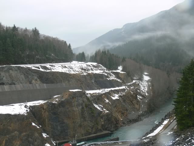
This picture shows the landslide that forms part of the dam. The bluff covered with trees, above the office, is the top of the landslide that came down from the ridge behind it 10,000 years ago. The landslide then was graded on the front, and riprap stones were applied to the front (to absorb wave energy), but the inner buildup is nothing like the engineered earthen/clay/rock dam in the foreground.
,
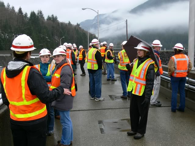

My long-time colleague Councilwoman Terri Brier studies the situation from the bridge that leads to the gate-house.
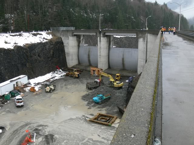
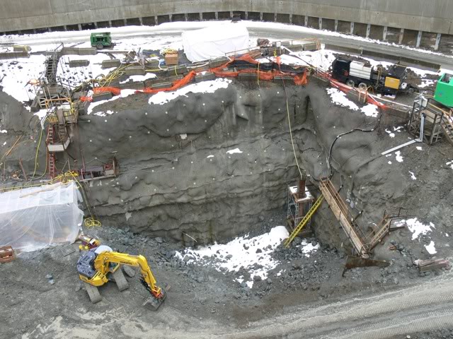
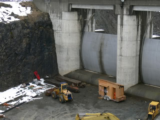
Excavators are digging a 150 foot deep hole, just upstream of the spillway gates, as part of a 160 million dollar upgrade which will provide fish passage and allow the Dam to permanently store more water for the city of Tacoma. A temporary “coffer dam” is keeping water out of the excavation site.
Here, Colonel Wright shows the approximate water-line at which he would limit storage if a storm occurred today, which compares to the next picture…
Here, Colonel Write stands where the water line was in January… shortly below the sink hole.
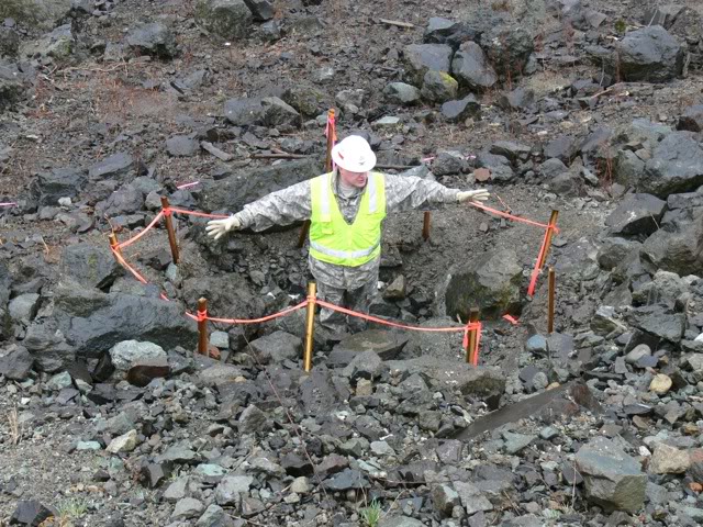
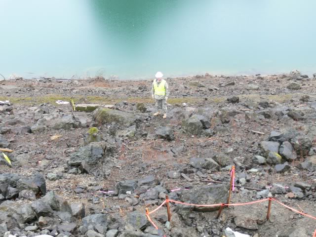
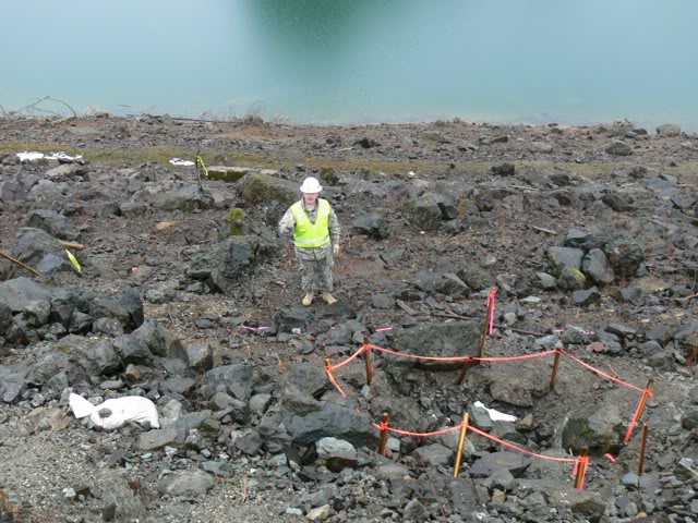
Colonel Wright stands in the sink-hole which is the primary evidence that material has washed away from inside the ancient landslide which holds the water back.
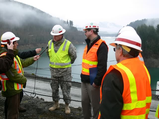
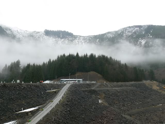
Colonel Wright briefs us all on the purpose and history of the Howard Hanson Dam. You can see how vast the reservoir is in the background.
Here is a view of the downstream side of the Dam, with the never-used paved spillway on the far left. (Water is released through a controlled gate and tube during normal operation)
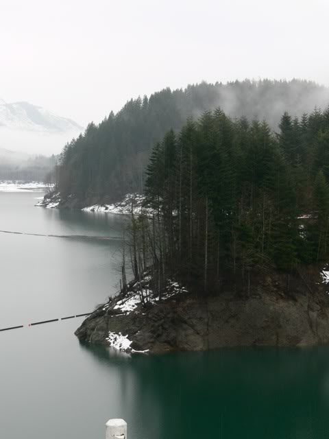
A final shot in an attempt to show how beautiful the area is. (I was pretending to be the photographer Ansel Adams for this one.)

Leave a Reply